
Don’t you just love technology? OK, so it kind of takes over our lives sometimes and swallows up too much of our free time (if we let it), but on the whole technology enriches our everyday lives. Here in the West of Ireland I use Google Earth to look for likely places to fish. Much of the fishing for trout on the small rivers around here is not recorded or easily available, even to locals. Trout are seen as inferior to salmon and nobody really pays them much attention, which is a bit of a double-edged sword. The rivers are in general lightly fished once you are off the beaten track but they are heavily overgrown and access to the banks is a royal pain in the bum.

Today is a cold and miserable day outside, so after our normal walk Nessie and I are settled in the warmth of the sitting room. Laptop open and internet connected I am scanning Google Earth for tell tale signs of potential new fishing spots. There is a logical sequence to this process, the first question being can I even get to a part of the river? You see roads in Mayo are few and often end some distance for the riverbank. Even if there is tarmac close to the water, deep drains or rough ground can make the few hundred yards between the place the car is parked and the river difficult or even dangerous. And don’t even start me on parking! As a rule there is nowhere to park. Roadside verges are universally soft/boggy and more than once I have returned to find the old VW listing heavily to one side where she has sunk in the muck. Roads are very narrow and used by farm machines mainly, so you have to be very careful when looking for a spot to park up. Right now I am eyeing up a section of the River Robe I have never fished before and I can see why – there is no road close by and there are lots of wide drains in the area. I will keep looking……………..

A very productive stream which I found thanks to Google Earth
Hang on, here is the remains of the old disused Sligo to Galway railway track which may just be OK for parking the car. It is still quite a long way from the river but in my experience the old railway is good for walking on and this could be just what I am looking for. A lot will depend on the ground and if it is solid enough for parking, but it looks promising so far.

The river is off this map, just to the North along the disused railway track
Now comes the second step – is this stretch even worth fishing? These limestone rivers often have long, deep, slow stretches which hold very few trout. For example, the 4 miles immediately upstream of Ballinrobe are almost dead straight, 10 – 20 feet deep and resemble a canal more than a river. Great of you are fishing for Pike but pretty rubbish for Brownies.
Now for the final step. This is where technology really helps out. Zooming in to an eye height of about 200 metres there is sufficiently good resolution to make out key features of the river. Bigger stuff like weirs and bridges are easy to find of course, but I look for any feature which could possibly be of interest to the fish and therefore to me. Sharp bends, fallen trees, shallows, narrows etc could all possibly be spots worthy of a few casts.
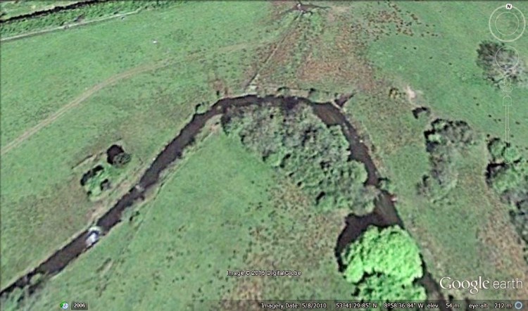
Above is a screen shot of a short section of the Robe which I have fished for several seasons now. The most obvious feature is the falls on the bottom left of the photo. I initially thought this would be a great pool but in practice it is very deep and turbulent and has only yielded an occasional trout for me. The river is shallow above that pool and holds mainly small fish, but wading upstream I found a good lie under that bright green tree in the bottom right of the shot. So your original target pools may end up not being that good but you can still find good fish in that area.
Depending on the time of year when the images were taken it is sometimes possible to make out weedbeds under the surface. Streamy water appears as lighter areas and while it is impossible to make out things like individual rocks which divide the flow it there is sufficient evidence to make intelligent guesses about where fish would lie. This is not an exact science and many, many times I have been disappointed to find upon arrival the river is not accessible/fishable. Then again, this usage of Google Earth has led me to some truly wonderful fishing that would have taken me much longer to find by simply wandering up or downstream from a bridge (the normal method hereabouts).
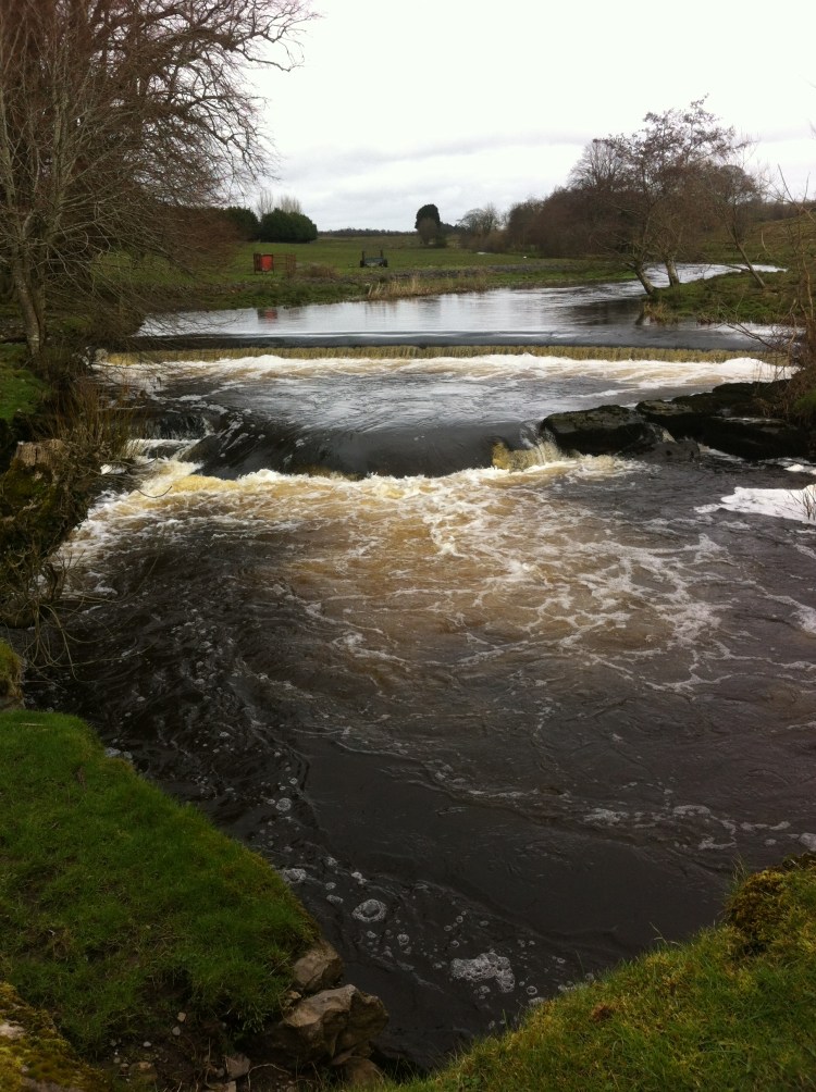
Features like this weir as easy to find, see below:

In summary, Google Earth is a valuable tool when time is at a premium and hours/days spent driving down country boreens (roads) and hiking across fields only to find barren water is a waste of time. With experience you can make a pretty good guess at where to try and save you a lot of time and hassle. Always remember to ask for permission from landowners before crossing fields and follow the country code, closing all gates behind you.
If you found this post useful why not follow me? Just hit the button and you will get al my latest posts.

